Utilities, Survey, Site, Drawing, and Modelling
Keep up with the evolution of the services industry.
From it’s inception in 2013 the Australian standard for utility locating, the AS5488, has been updated and amended regularly. As the utility-locating and construction-engineering sectors grow together, the requirements for ‘smart data’ increases.
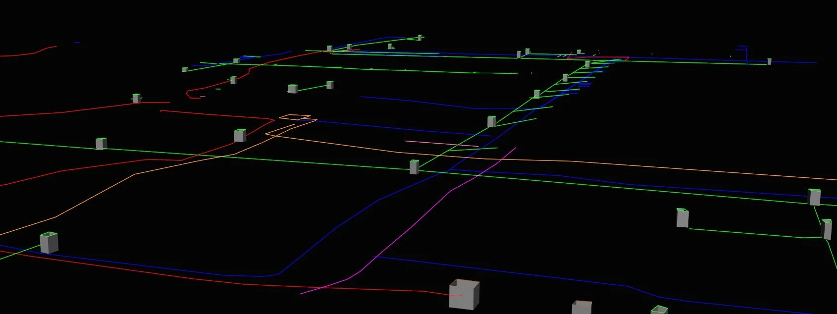
3d modelling is a critical element in design, clash analysis, and prestart investigations.
A CAD or pdf drawing are great for on-site navigation, permit creation, and walk-rounds, but your design partners are best served by offering fully realised underground pipe network models.
Offering these as part of your deliverable suite saves project time and greatly reduces the risk of errors being introduced as an engineer attempts to build a model out of basic data.
A unified system taking you from field survey to 3d modelling.
All the elements of the OPA drafting solutions system are built to provide you with the workflow locate-survey-process-digital-drawing-modelling seamlessly.
It also has the benefit of being able to produce the more basic product, a drawing, but still allows you to retroactively address the digital data and provide a client or design partner with the higher standard ‘smart data’ product, with little additional work or cost to yourselves.
“Joe Public” isn’t going to want a fully realised network model for their subdivision build, but they will need drawings. Tier 1 infrastructure projects require specific schemas, attribute lists, pipe networks, and drawings for site use. A design partner may not need drawings at all, only the network model.
What if you had one workflow that serviced all the above? With negligible additional cost?
That’s what we offer, either for yourselves to manage internally, or as a service provided to you.